National Weather Service Weather Story |
Thornton Weather Forecast 48 Hour Graphical Forecast |
| WEATHER STORY Denver/Boulder Weather Forecast Office |
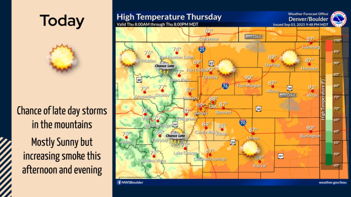
|
|
![]() |
|
|
A round of snow is expected for most of northeast and north central Colorado starting this weekend. Snow will first start in the far northern mountains late tonight, and then spread slowly southward into the I-70 mountain corridor and Summit County late Saturday afternoon and evening. Areas of snow will then develop onto the I-25 Corridor and adjacent plaisn behind the passage of a cold front Saturday night. There is considerable uncertainty with regard to the amount of snow, since we anticipate bands of snow. Thus, some areas may receive very little or no snow, while others get a few inches. Stay tuned for the latest updates, and prepare for winter travel starting in the mountains late tonight through Saturday evening, and along the I-25 Corridor and adjacent plains starting Saturday night. Travel impacts will last into Sunday morning before snow ends from north to south. Finally, temperatures will be much colder by Sunday with high temperatures forecast to stay below freezing.
|
Select a Different Office Below
Data Courtesy of Denver/Boulder Weather Forecast Office
